Total Pageviews

Monday, April 4, 2011

The trees are real, and they are spectacular!

The long and winding road
The detour around the landslide that took two days was worth it.  We had to go quite far south along the coast, then cut east over the mountains (crazy road), turn north up Interstate 5 (easy drive), head west on highway 299 back over the mountains (even crazier road-saw a woman barfing on the side-she was likely car sick.  It would be horrible as a passenger in the back seat), then turn south again to get to the Avenue of the Giants.
By the time we finished driving on highway 299 (the crazy winding road) it was dinner time.  Fortunately, we weren't tossing ours like the lady was but we needed to find a place for the night.  Camping in California is very expensive.  The state parks are $35 a night and they don't have electric hook ups.  We just spent two nights in a private park which cost $48 per night.


"Campino"-camping at the casino

Casinos here allow RVs to spend the night in their parking lot.  The Garmin showed a casino-the Cher-Ae Heights Casino, and we pulled in there.  It was kind of hard to find and a little out of the way but it was in a great spot overlooking the Pacific.  After dinner in the van we went in to the casino to join their member club-casinos give you free credit to play with in the slot machines when you join.  We got really lucky-they gave me $50 and Al $75.  We played on their money and came out with $59, plus stayed there for free.  We have a new term -campino-means camping at the casino.  We're now fans of the idea. 
After our restful night at the campino we headed south to the Avenue of the Giants.  This road is a scenic 31 mile tour of the giant redwoods, within the Humboldt Redwoods State Park.  

These trees are huge. The largest redwood on record is the Dyerville Giant.  It fell in 1991 and now it is laying on the forest floor.  It measures 370 feet long (two feet taller than Niagara Falls).  It is 17 ft in diameter, 52 feet in circumference and probably weighs over 1 000 000 pounds. 


Fallen Dyerville Giant-look way down-you'll see
Al at the 100 ft point


Roots of fallen redwood


Fetch boy!


The greatest accumulation of plant mass ever recorded was in a redwood stand here in this park.  This temperate rainforest region has seven times the living and dead organic material of that found in a tropical rainforest.  Redwoods are so huge that they live in three climate zones at once.  The base of each tree is in one set of climatic conditions, the stem in an other, and the crown in yet another.  The trees can be experiencing cool, moist conditions at their base, and at the same time have dry, windy conditions at the top.  Redwoods need great amounts of moisture-65 inches of rainfall per year.  They help create their own microclimate through the transpiration of moisture from the leaves to the atmosphere.  A very large redwood can release up to 500 gallons of water into the air per day.    


We stopped in at the Redwood visitors centre.  On display was a motorhome made out of one fallen redwood trunk.  Charles Kellogg built it and called it the Travel Log.  He took it on tour in 1917 to bring awareness of the need to save the redwood forests to the rest of the USA.
inside-the-worlds-first-rv.jpg
Inside the motor-home
complete with bed, dresser,
sink, toilet
outside-the-worlds-first-rv.jpg
Outside of motor-home, carved out of one tree trunk
Back on the highway, heading north up the coast, we saw a warning sign with a flashing light.  It read, "Watch for Elk next 2 miles."  We turned a bend and there they were.  A whole herd!!


Friday, April 1, 2011

Northern California's Pacific Coast


It was more like the next 40 miles
This area of Northern California has a unique geography.  The Pacific Ocean rolls up to a strip of flat land; this is where all the coastal towns are.  Then the mountains poke up.  They are quite high, with elevations over 2000 feet.  On the other side of the mountains lies the wine region. 
 

This was a 2 way road-posted at 55 mph


On the map the road over the mountains looks quick-about 40 miles.  Way wrong!  It took us HOURS.  The road was wild.  It narrowed in spots to one lane, no guardrail, very steep.  In one place the grade was posted at 16%.  The steepest grade we had ever seen before this was 11% in Quebec.  We couldn't drive faster than 30 miles an hour on this white knuckle ride.  Finally,we drove down a hill and there was the ocean before us.  We're not sure if it was the ocean view or the realization that we made it out alive that made us so happy.


Loving the beach

We turned north and drove along Highway 1 which follows the coast.  It was beautiful.  We did pass many signs on the road warning us of a mudslide ahead.  Most were cleaned up but we could see the remains of the debris.  There were also signs warning of tsunami danger zones. 


The California north coast is rocky; the south coast
beaches are fine sand 
 We stopped for the night at a state park in Fort Bragg, California.  Fort Bragg is a picturesque small town, however, we saw more homeless people here than we have seen anywhere.  We stopped at the McDonalds in town and there were a number of homeless people lurking around the side and back area.  In particular, there was a guy and girl and two dogs camped out on the grass leading up to the drive-through window.  They had a sign saying they were hungry.  We have never seen anyone begging at the drive-through window before.  Then we saw a man who was clearly living in his car.  It was loaded with junk, and three cats.  It was hard to see inside the car because the windows were so filthy.

  
We did spend some time walking along the shoreline at the state park.  This park is on the whale migration route and we were hoping to see a gray whale moving north.  We didn't, but we did see harbor seals sunning themselves on some rocks just off shore.  The state park ranger told us that we had to keep Sid away from the seals because dogs and seals share some diseases and seals carry a particular virus that Sid could catch. 


Since Fort Bragg was so sketchy we moved north to a KOA campground.  It is right on the ocean and we've been frolicking in the waves.
It's a good thing we stopped here because we found out that a massive mudslide landed in the middle of Highway 101 (the only route north along the coast).  The state estimates it will take at least a week to clean it up and repair the highway-the road buckled up on both sides of the slide. 


Mudslide on Highway 1, 60 miles south of Eureka, California
We planned to head north on Highway 101 up to the Avenue of the Giants to see the giant redwoods.  We will have to take a detour which is about a day long.  Due to the unique geography of the area we have to go south, then cross back over the mountains and take Highway 5 north, then swing in from the north.  We couldn't see the giant sequoias because of the snow and now mud is hampering us from these redwoods.  We want to see the damn trees!!


Pacific Ocean view from our van


Wednesday, March 30, 2011

Wine Country


We said goodbye to San Francisco, and headed north to the Napa Valley wine country.
  The Napa Valley wine region is nestled in between two mountain ridges, which moderate the climate, making the grapes just right for wine.


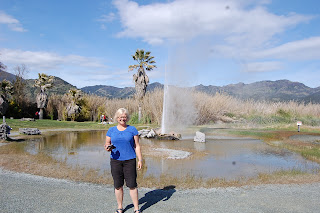
The geology of the area is also perfect for a geyser-and California's "Old Faithful" was our next destination.  Geysers exist only where there is a natural supply of underground water, a source of heat and a series of cracks and cavities in the underground rock.  The surrounding rocks must be strong enough to maintain the intense pressure of steam explosion.  Here in Calistoga, California the underground river flows over the hot magma, which boils it.  That super hot water collects in the cavities, until the cavity is full.  At first, steam puffs shoot out of the geyser hole.  Then, the water, 350 degrees hot, shoots approximately 60 feet into the air for around 3-4 minutes. 

Old Faithful


Here' s a video of an eruption 


 There are only a few geysers in the world that earn the label "Old Faithful."  These perform at regular intervals.  This geyser erupts, on average, 40 minutes apart, all the time.  Conditions which cause a deviation from that normal pattern seem to relate to earthquakes.  When we visited, Old Faithful was erupting around 8 minutes apart.  We found out that the frequent eruptions were a good thing.  From two days to two weeks  before an earthquake, Old Faithful delays its 40 minutes apart eruptions to a longer interval.  Geologists determine if the digressions are related to tectonic movement-and how likely an earthquake is.

Wine tasting in Napa Valley-Yum

 
These grape vines are so old
they are as thick as trees


A little wine and cheese party.  Didn't have wine glasses. 
We thought the water tumbler and coffee mug were a better choice than Tupperware.

Next, we drove through the wine area.  It is like the Niagara Region except Napa is much more established, with well developed vineyards and elaborate wine tour establishments.  This is a very wealthy area.  We bought a bottle to try.  It was an early night for Kim.

Tuesday, March 29, 2011

San Francisco


Ah, the rain has finally stopped.  While the sun isn't completely shining, at least it's dry and the puddles are diminishing. 
We drove into San Francisco today.  What a great city!  We took an open-air, double-decker bus tour and saw all the sights:  Chinatown, Fisherman's Wharf, Little Italy.  The upper deck gave us a nice view, even though it was very windy and quite cool up there. 

Street cars

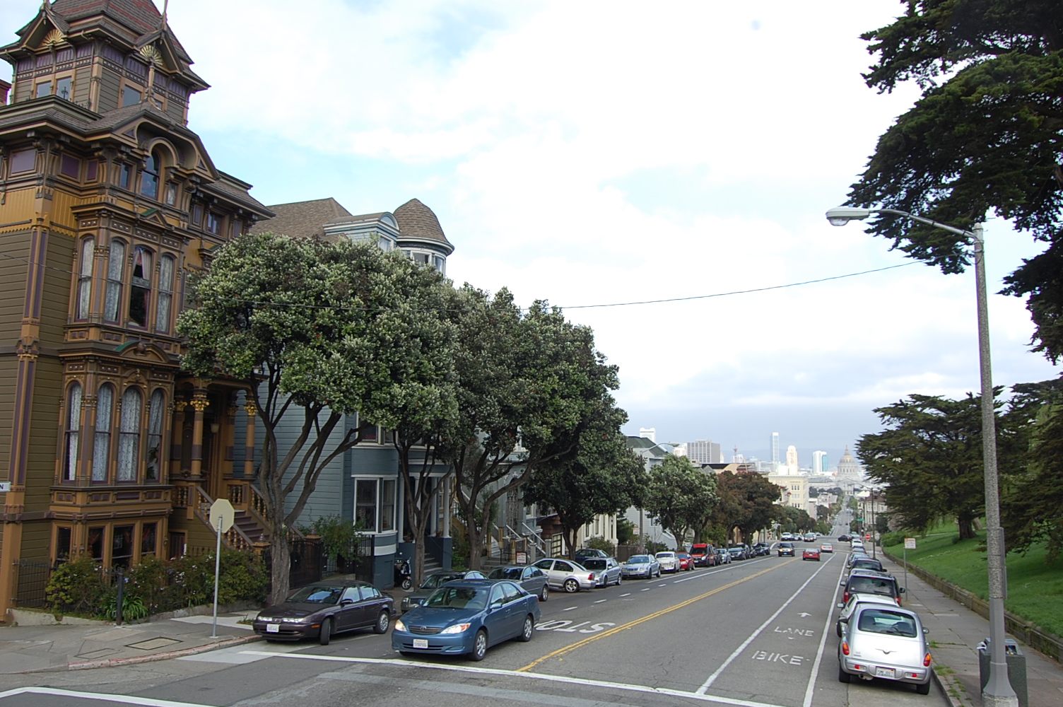
Street scape

View from the top of the city


Some of San Francisco's "Painted Ladies"
These are Victorian-styled houses beautifully painted-the yellow one, right in the middle, is the one from the TV show, "Full House"
When we got closer to the Golden Gate Bridge it started to drizzle.  For the rest of the ride we toughed it out and stayed put up on top.  The Golden Gate Bridge is actually painted International Orange, not gold.  This orange colour is designed to provide better visibility for ships because the bridge is often shrouded in fog.  Keeping the bridge painted is an on-going task.  Someone is continually painting it-proving there is still such a thing as a job you can retire from. 
This bridge sees a huge number of vehicles crossing it daily and the toll is $5 per private vehicle.  This is a big cash cow for the City of San Francisco.


Our first view of the Golden Gate Bidge

During the tour we heard that people ride their bikes across the bridge and we decided to do that.  Fortunately, when we returned the next day (Monday, March 28) the weather was much nicer-bright and sunny, although still a little cool at 16 degrees (60 farenheit).

The total distance was 8 miles and while there were a couple of nasty hills, for the most part the bike path was level.  The bridge was quite busy with walkers and bikers.  Some bike riders are hard-core fitness buffs and some were riding their cruisers.  Oh, that was us!


A cross section of the cable


Sign on the Golden Gate Bridge
Apparently, death is the usual outcome for a jumper

Saturday, March 26, 2011

Dissention in the van


Eroded coastline south of Big Sur

We've had five days of rain.  We can't go to Big Sur or Monterey on the coast-the storm washed out the road.  There is major flooding throughout the area, and the ground is so saturated that tree roots are no longer holding up the trees.  The trees are falling on houses.  Due to heavy snowfall, the roads into Yosemite National Park are closed to traffic unless your car is escorted by the California Highway Patrol (ours isn't).


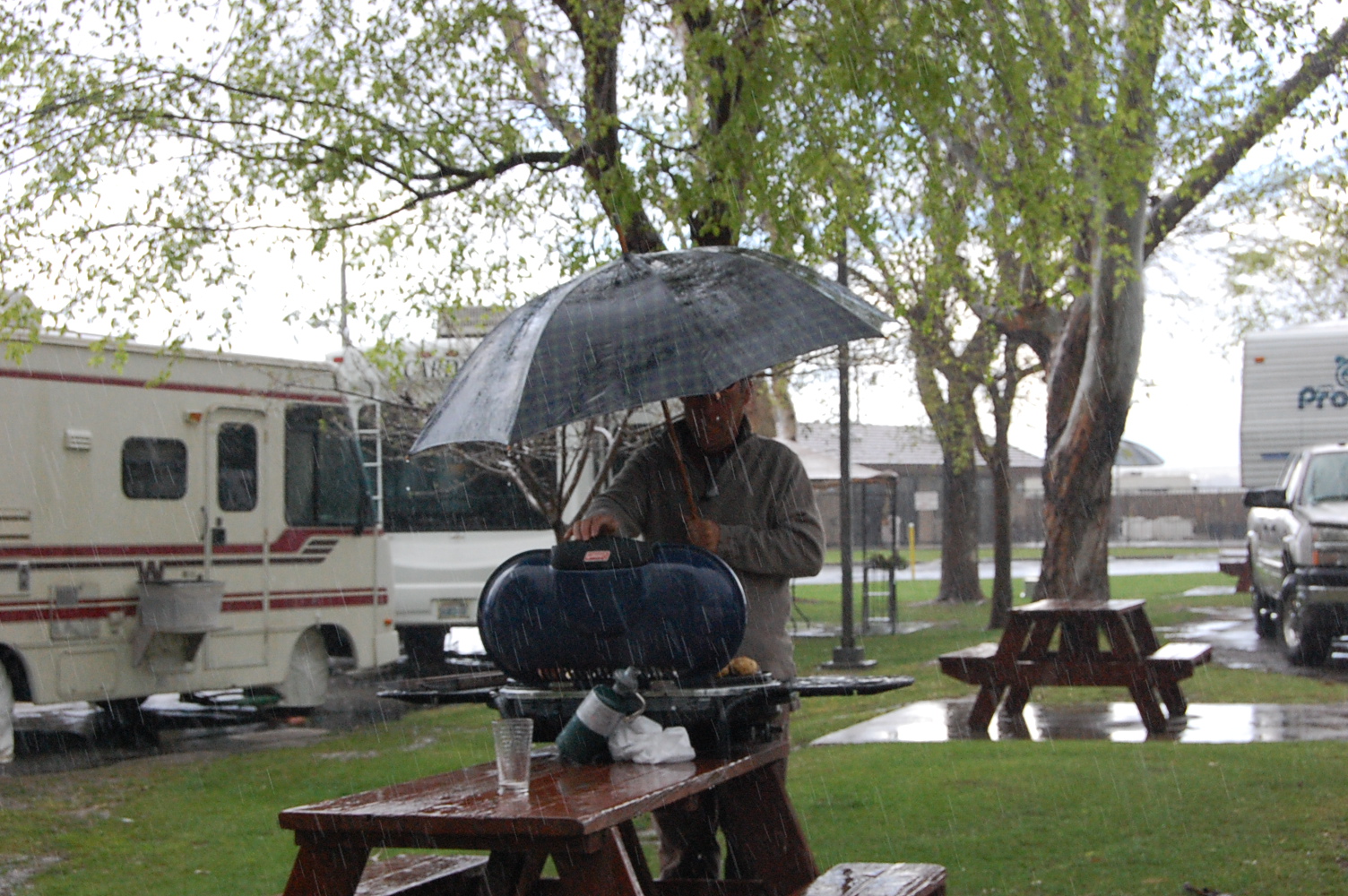
Nothing like the taste of BBQ

Campsite in San Francisco-carpets are hung to dry (they aren't drying!)


There are three of us in this van.  One of us wants to stay and tour San Francisco, thinking that the weather will only get better.  One of us wants to blow this pop stand and head back to the dry, warm weather of the desert.  One of us just wants to get out of the damn van and go for a walk.  Can you guess who's who?  Ten points if you guess all three correctly.


Let us out of here!!!
 

Thursday, March 24, 2011

Not so "Sunny California"

The big news here in California is the weather.  It's bad.  When we were in Death Valley we didn't know what the outside weather was like because we didn't have electricity.  So, no TV, no radio, no internet, therefore, no news.  
When we left Death Valley we drove along the snowy mountain highway to Bakersfield.  We didn't know that the highway had been closed and that motorists had been stranded for hours in their vehicles just hours before us.  We were oblivious; happily driving the marshmallow along the snowy road, like two Canadians would.  We saw it on the news later that day.  Who knew that snow closed roads in California?  Isn't that a Stratford thing?


Our next destination was Sequoia National Park, home to the General Sherman-the largest tree (by volume) in the world.   It is 279.4 feet tall, with a circumference of 102.9 feet, and a diameter of  36.5 feet at the base.  With a full tank of gas, we headed for the park.
This is a picture of the tree
 we didn't get to see
These giant sequoias grow high up in the mountains.  When we got to the ranger station, the ranger told us that we needed chains on our tires in order to reach the site of the General Sherman.  The storm we went through dumped 2 feet more of snow on the road the day before and it was not passable without chains. In the small town at the park's entrance we saw stores renting chains, and we scoffed at that.  It is hard to imagine that back in Bakersfield it was lush and green; oranges were being picked off trees and less than 2 hours away we needed chains on our tires. 
We didn't have chains-we didn't see the General Sherman. 


The park was scenic, so we walked a short trail down to one of the mountain rivers, then saddled up and headed for the Pacific Coast.  We're going to drive along highway 1 to Big Sur.  We'll be living life on the edge-literally!  One hundred feet of coastline road washed into the ocean near Big Sur and we want to check it out.   


Foothills-deceptively pretty mountains (treacherous at the top)


Prickly Pear cactus in Bakersfield