Total Pageviews

Wednesday, March 30, 2011

Wine Country


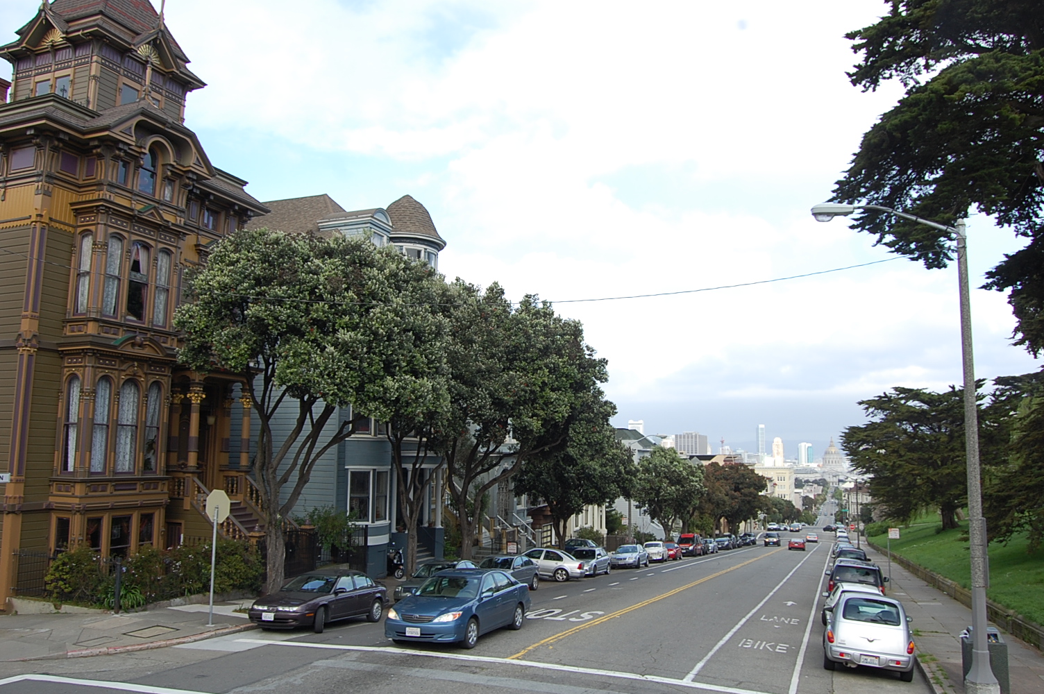
We said goodbye to San Francisco, and headed north to the Napa Valley wine country.
  The Napa Valley wine region is nestled in between two mountain ridges, which moderate the climate, making the grapes just right for wine.


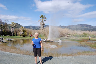
The geology of the area is also perfect for a geyser-and California's "Old Faithful" was our next destination.  Geysers exist only where there is a natural supply of underground water, a source of heat and a series of cracks and cavities in the underground rock.  The surrounding rocks must be strong enough to maintain the intense pressure of steam explosion.  Here in Calistoga, California the underground river flows over the hot magma, which boils it.  That super hot water collects in the cavities, until the cavity is full.  At first, steam puffs shoot out of the geyser hole.  Then, the water, 350 degrees hot, shoots approximately 60 feet into the air for around 3-4 minutes. 

Old Faithful


Here' s a video of an eruption 


 There are only a few geysers in the world that earn the label "Old Faithful."  These perform at regular intervals.  This geyser erupts, on average, 40 minutes apart, all the time.  Conditions which cause a deviation from that normal pattern seem to relate to earthquakes.  When we visited, Old Faithful was erupting around 8 minutes apart.  We found out that the frequent eruptions were a good thing.  From two days to two weeks  before an earthquake, Old Faithful delays its 40 minutes apart eruptions to a longer interval.  Geologists determine if the digressions are related to tectonic movement-and how likely an earthquake is.

Wine tasting in Napa Valley-Yum

 
These grape vines are so old
they are as thick as trees


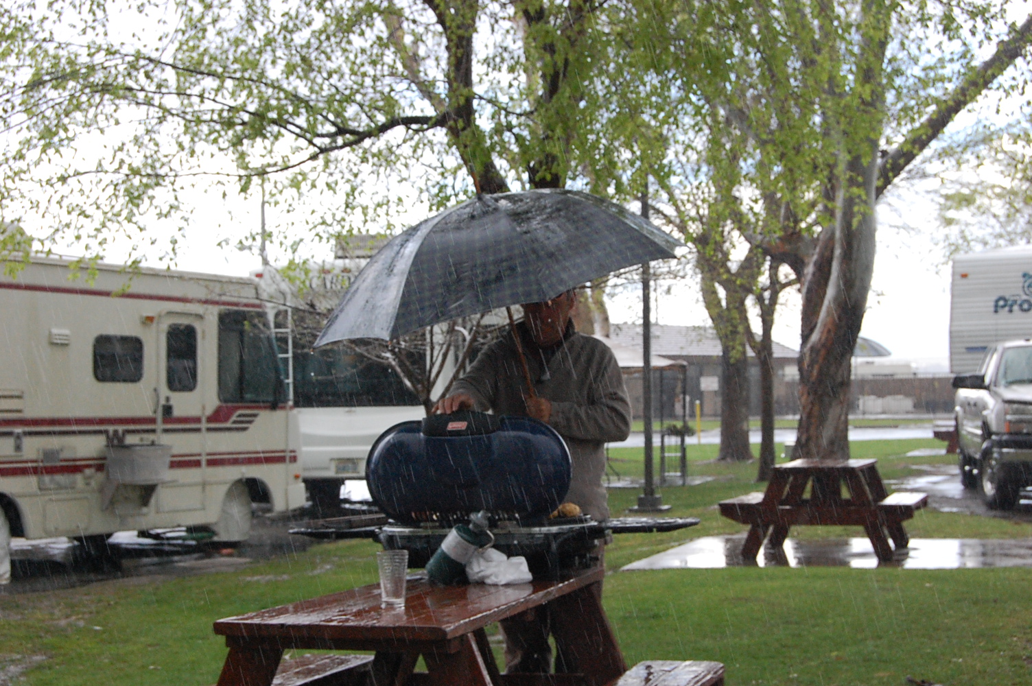
A little wine and cheese party.  Didn't have wine glasses. 
We thought the water tumbler and coffee mug were a better choice than Tupperware.

Next, we drove through the wine area.  It is like the Niagara Region except Napa is much more established, with well developed vineyards and elaborate wine tour establishments.  This is a very wealthy area.  We bought a bottle to try.  It was an early night for Kim.

Tuesday, March 29, 2011

San Francisco


Ah, the rain has finally stopped.  While the sun isn't completely shining, at least it's dry and the puddles are diminishing. 
We drove into San Francisco today.  What a great city!  We took an open-air, double-decker bus tour and saw all the sights:  Chinatown, Fisherman's Wharf, Little Italy.  The upper deck gave us a nice view, even though it was very windy and quite cool up there. 

Street cars

Street scape

View from the top of the city


Some of San Francisco's "Painted Ladies"
These are Victorian-styled houses beautifully painted-the yellow one, right in the middle, is the one from the TV show, "Full House"
When we got closer to the Golden Gate Bridge it started to drizzle.  For the rest of the ride we toughed it out and stayed put up on top.  The Golden Gate Bridge is actually painted International Orange, not gold.  This orange colour is designed to provide better visibility for ships because the bridge is often shrouded in fog.  Keeping the bridge painted is an on-going task.  Someone is continually painting it-proving there is still such a thing as a job you can retire from. 
This bridge sees a huge number of vehicles crossing it daily and the toll is $5 per private vehicle.  This is a big cash cow for the City of San Francisco.


Our first view of the Golden Gate Bidge

During the tour we heard that people ride their bikes across the bridge and we decided to do that.  Fortunately, when we returned the next day (Monday, March 28) the weather was much nicer-bright and sunny, although still a little cool at 16 degrees (60 farenheit).

The total distance was 8 miles and while there were a couple of nasty hills, for the most part the bike path was level.  The bridge was quite busy with walkers and bikers.  Some bike riders are hard-core fitness buffs and some were riding their cruisers.  Oh, that was us!


A cross section of the cable


Sign on the Golden Gate Bridge
Apparently, death is the usual outcome for a jumper

Saturday, March 26, 2011

Dissention in the van


Eroded coastline south of Big Sur

We've had five days of rain.  We can't go to Big Sur or Monterey on the coast-the storm washed out the road.  There is major flooding throughout the area, and the ground is so saturated that tree roots are no longer holding up the trees.  The trees are falling on houses.  Due to heavy snowfall, the roads into Yosemite National Park are closed to traffic unless your car is escorted by the California Highway Patrol (ours isn't).


Nothing like the taste of BBQ

Campsite in San Francisco-carpets are hung to dry (they aren't drying!)


There are three of us in this van.  One of us wants to stay and tour San Francisco, thinking that the weather will only get better.  One of us wants to blow this pop stand and head back to the dry, warm weather of the desert.  One of us just wants to get out of the damn van and go for a walk.  Can you guess who's who?  Ten points if you guess all three correctly.


Let us out of here!!!
 

Thursday, March 24, 2011

Not so "Sunny California"

The big news here in California is the weather.  It's bad.  When we were in Death Valley we didn't know what the outside weather was like because we didn't have electricity.  So, no TV, no radio, no internet, therefore, no news.  
When we left Death Valley we drove along the snowy mountain highway to Bakersfield.  We didn't know that the highway had been closed and that motorists had been stranded for hours in their vehicles just hours before us.  We were oblivious; happily driving the marshmallow along the snowy road, like two Canadians would.  We saw it on the news later that day.  Who knew that snow closed roads in California?  Isn't that a Stratford thing?


Our next destination was Sequoia National Park, home to the General Sherman-the largest tree (by volume) in the world.   It is 279.4 feet tall, with a circumference of 102.9 feet, and a diameter of  36.5 feet at the base.  With a full tank of gas, we headed for the park.
This is a picture of the tree
 we didn't get to see
These giant sequoias grow high up in the mountains.  When we got to the ranger station, the ranger told us that we needed chains on our tires in order to reach the site of the General Sherman.  The storm we went through dumped 2 feet more of snow on the road the day before and it was not passable without chains. In the small town at the park's entrance we saw stores renting chains, and we scoffed at that.  It is hard to imagine that back in Bakersfield it was lush and green; oranges were being picked off trees and less than 2 hours away we needed chains on our tires. 
We didn't have chains-we didn't see the General Sherman. 


The park was scenic, so we walked a short trail down to one of the mountain rivers, then saddled up and headed for the Pacific Coast.  We're going to drive along highway 1 to Big Sur.  We'll be living life on the edge-literally!  One hundred feet of coastline road washed into the ocean near Big Sur and we want to check it out.   


Foothills-deceptively pretty mountains (treacherous at the top)


Prickly Pear cactus in Bakersfield


Tuesday, March 22, 2011

Death Valley

It was a long drive from Chula Vista, on the Pacific coast, the most southwest point in the US, inland to Death Valley.  It was overcast along the way and we even had a few raindrops.  This is the first rain we've seen in 43 days.  It's a cool day, too.  There is a storm approaching San Diego so it's time to head back up into the desert-they don't get much rain there.

Huge Joshua tree enroute


Desert scrubland dotted with mesquite bushes


It seems like the lush green valley quickly morphed into the scrubland of the Mojave Desert.  We saw lots of dry lakes.  They look like vast patches of white sand.  There are lots of motorcycle and ATV trails through these hills.  Looks like fun. 


Mountains as we enter death Valley

Our camp in the mountains - we woke to snow


View from our camp


The road into Death Valley was very rough.  The highway up to the park went through three very small, very poor and run down towns. 
We could see three factories-Borax factories we later learned-which were operating but it was clear the people in the towns weren't benefitting from them.  This was a really poor area. 


Town of Trona housing-just one of many


Turns out those dry lakes, which look like white sand, are really big borax deposits. 


Borax deposit-the white stuff


The mineral, borax, is mined here.  At first, back in the late 1800s and early 1900s, borax was mined and hauled out of the area by 20 mule teams.  Now it's hauled out by semis. 

Original twenty-mule team wagon.  Note the size of the front and back wheels. 
Tank on the back is a water tank for the mules


We drove along Wildrose Road into the National Park.  This was a narrow, two-way road and at times there was partial paving on one tire track.  The rest of the time it was potholed and washboard bumpy.  Wild ride in. 
We camped at Wildrose Campground.  It was very primitive (read that to be no flush toilets, water or electricity).  At least it was free.
We spent an exceptionally cold night, with gusty winds at Wildrose.  We had our furnace churning out heat and we used our Mexican blanket to keep warm.  There were campers here who spent the night shivering in tents.  Some of them moved to their cars and turned on the motor for heat. 
We woke up to snow!  We thought that a desert destination would mean no rain.  Well, we got snow instead. 


We were up quite high-our elevation was higher than 4000 ft.  Anything lower got rain.  Here in Death Valley they sometimes go two years without precipitation-and we're here for it.  Just great.


Death Valley is an area of extremes.  It's highest peak is Telescope Peak, at 11,049 ft.  Almost right below this high point is Badwater.  This is the lowest point in North America at 282 ft below sea level.  Badwater is also the driest and hottest place in North America.  The day we were there it rained and was 45 degrees.  Not dry, not hot. Still low.


Sunrise in Death Valley
 One the drive out of Death Valley it was still cold, but at least not raining or snowing.  As we headed west to Bakersfield we had to drive on snowy, twisting mountain roads.  We were very low on gas (the mountains really eat it up out of the gas tank.)  We chose not to fill up at $5.29 a gallon in Death Valley.  The usual price was $3.89 a gallon.  The Garmin said there were three gas stations in Trona (the very poor little town we saw on the way in).  It was only 20 miles to Trona.  When we got there, we pulled up to the first gas station.  Whew, we made it!  OUT OF BUSINESS.  That's okay.  There was another one just up the road.  Got there.  This station also had a convenience store attached and the sign read $3.99 a gallon.  We were thinking that 10 cents more per gallon was okay and certainly better than $5.29.  As we pulled up to the pumps we saw they were all shut off.  Oh no-nothing to do but drive on to the third station.  It was closed, too.  The next town was 24 miles away.  We held our breath, coasted down hills in neutral and hoped we made it.  We had our bikes in case we had to bike in to town for gas.  Gee, we made it.  We limped into the gas station where gas was $3.89.  At that point we would have happily paid $5.29.

San Diego

We left the oppulance of Palm Springs and headed south to San Diego.   Palm Springs lies close to the line of the San Andreas Fault, which passes along the middle of the Coachella Valley. We traveled southwest through the San Gorgonio Pass.  The road was a ribbon through the mountains.  North of the pass we could see the snow topped San Bernardino Mountains.


 San Diego is immediately adjacent to the Mexican boarder. The birthplace of California, San Diego is known for its mild year-round climate, its natural deep-water harbor, and its long association with the US Navy.
There is lots of Spanish influence down here.  Tile rooftops and mission style buildings are everywhere.


Spanish style fountain
Mexican restaurants everywhere.  We have decided we're done with Mexican food for awhile. 
In San Diego we parked the van and took a trolley tour.  The weather was sunny but cool so Sid was fine waiting in the van.  The trolley tour took two hours and it was a great way to see the major sites. 

Trolley Ride through San Diego

We spent time in Old Town.  This is the first place to be inhabited as a town in San Diego.  It is set up as a historic site, with the centre of the town a large square, around which are shops that existed back in the day.  There was a blacksmith, a tobaccoist, general store, things like that.  There were also the regular touristy type shops-one of which sold Mephisto shoes.  Yup.  They sold us a pair-great deal.  $85.


Covered wagon in Old Town


San Diego Bay
For dinner (see the aformentioned aversion to Mexican) we decided that San Diego, having a seacoast location, must have any number of good seafood restaurants.  We found one and enjoyed our shrimp overlooking San Diego Bay.  After dinner we drove further south to Chula Vista.  We spent the night in the furthest south west corner of the United States-just north (about one mile)  of the border into Tijuana, Mexico.  This was a very busy, very sketchy area and it wasn't a restful night's sleep.